Free Transportation Maps
 The
T.O.M.
GIS Routing software product is built
around E.S.R.I.’s ArcView GIS mapping software. By using this GIS
technology school districts many times can use detailed and accurate
street maps for FREE from local cities and counties.
STN Magazine says “over 2/3 of the approximate 3,500
counties in the U.S. have adopted the ArcView format” making ArcView
“the defacto standard nationwide in the field of GIS”. Because T.O.M.
GIS Routing uses ArcView you know that if your local city or county
government has a GIS map, T.O.M. will probably be able to use it. The
T.O.M.
GIS Routing software product is built
around E.S.R.I.’s ArcView GIS mapping software. By using this GIS
technology school districts many times can use detailed and accurate
street maps for FREE from local cities and counties.
STN Magazine says “over 2/3 of the approximate 3,500
counties in the U.S. have adopted the ArcView format” making ArcView
“the defacto standard nationwide in the field of GIS”. Because T.O.M.
GIS Routing uses ArcView you know that if your local city or county
government has a GIS map, T.O.M. will probably be able to use it.
View an excerpt of the quoted
STN article.
Contact your local city or county street transportation department,
water department, assessing or planing departments today and ask
them if they have a map of the city / county in an ArcView shapefile
or .shp file format that your school district can use. You will
probably be pleasantly surprised!
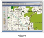
Click HERE to visit
the City of Phoenix's Online Map - which is offered FREE to local
school districts
What if My Local City or County doesn’t have a street map we can
use?
No Problem!
ESRI
has over 300,000 customer organizations world wide using it’s
software on millions of desk tops. Many of these users are looking
for good street maps. As such a healthy industry of commercial map
data companies has grown over the past twenty years. If your local
city or county doesn’t have a street map you can use there are many
commercial companies that do, allowing you to ‘shop’ for the best
one. The competition between these companies is heavy giving you
great maps for very competitive prices. Usually a detailed street
map for a county is priced from one to two thousand dollars. The
main idea here is choice. With T.O.M.
GIS Routing you have a lot of choices as
to where your school district can get it’s street map from.
Below are just a few of the companies that offer detailed street
maps in an ArcView format. Click on their logo to visit their web
sites. Many of these companies allow you to ‘test drive’ their maps
by typing in street addresses and having their web page show where
on their map that location is:
Geographic Data Technology
Tele Atlas
NavTeq
|
"...Fortunately for school administrators,
state and municipal governments have seen the benefits of the
technology too. Most standard GIS area maps are now available
for free from municipal or county governments. Environmental
System Research Institute, better known as ESRI, has become the
defacto standard nationwide in the field of GIS. At the heart of
the ESRI technology is geocoding, the process of assigning
latitude and longitude coordinates.
ESRI surged to the forefront in the mid-1990s when the U.S.
Census Bureau adopted ArcView, the company's non-proprietary
data structure based on worldwide latitude and longitude
coordinates. All 50-state departments of transportation, and an
estimated two-thirds of the 3,500 county governments nationwide,
have adopted ESRI's GIS protocol.
Moreover, key federal agencies - among them the U.S. Geological
Service, Census Bureau, Department of Transportation, Department
of Defense - utilize digital mapping for an array of
applications. Map files are available for transportation
planning, 911 emergency systems, crime data, ethnic and racial
demographics, flood areas, aboveground and underground
utilities, railroad tracks, indeed virtually any conceptual or
physical item on the planet. By viewing data in layers within a
student transport service area, school transportation
departments can avoid dangerous routes while simultaneously
building digital efficiencies into the routing.
No Cost Maps
That means school administrators can combine their database of
student information with existing digital map files supplied by
government..." |
|
 Testimonials Testimonials
|
"T.O.M. really works! The automatic assignment of drivers and buses is a wonderful feature. Last week I clicked one button and T.O.M. automatically assigned all of the drivers and vehicles for 90 field trips! I really like T.O.M.?s reports too!"
Sue Collins
Hillsboro School District
Hillsboro, Oregon
|
|
"'I LOVE T.O.M.', T.O.M. helps to make my day at work a better one.
"
Deborah Cole
|
|
|